Challenges Faced by Ships Sailing Near Iran Due to GPS Jamming
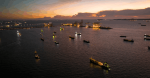
Ships sailing through the Gulf are facing serious problems as their tracking signals are being jammed, causing confusion about their real locations. In a latest incident on Sunday, the large oil tanker Front Tyne was traveling between Iran and the United Arab Emirates.
At 9:40 a.m., ship-tracking data showed the vessel far away from the Gulf, in Russia, in a region known for growing barley and sugar beets. But the ship was actually nowhere near Russia.
A few hours later, around 4:15 p.m., the data showed the ship in southern Iran, near the town of Bidkhun. Then the signals kept jumping, moving the ship back and forth across the Gulf.
This strange behavior wasn’t a mistake in the ship’s system. Experts say the signals were being jammed, which has become a growing issue in this area. According to shipping analysis firm Windward, nearly 1,000 ships in the Gulf have been affected by signal interference since the conflict between Israel and Iran began.
On Tuesday, two oil tankers collided south of the Strait of Hormuz, a narrow but extremely important waterway that handles a large portion of the world’s oil shipments. Both ships caught fire after the crash.
One of the tankers involved was the Front Eagle, which is similar in size to the Front Tyne, more than three football fields long. Just days earlier, on June 15, tracking data from Kpler, a commodity data platform, showed the Front Eagle located onshore in Iran, which is clearly impossible for a ship of that size.
Normally, there is little or no signal interference in the Strait of Hormuz. But now, it has increased a lot. Ami Daniel, who leads Windward, explained that this raises the risk for ships in the area. He said that when ships can’t be accurately located, the chances of accidents go up because the region is already tense and dangerous.
Ships are required to send out regular signals about their location, speed, and direction using a system called AIS (Automatic Identification System), which works like GPS for ships. However, these systems can be disrupted.
If a ship’s crew changes its signal on purpose to hide where it’s going or what it’s carrying, that’s called “spoofing.” But in the Gulf, experts say it’s third parties doing the jamming-this means someone from outside is blocking or interfering with the GPS signals.
Dimitris Ampatzidis, an analyst at Kpler, explained that jamming like this is common in areas where conflicts are happening. Some military forces use jamming to hide their ships or protect other targets from being found.
This isn’t the first time jamming has affected shipping. Similar disruptions have been seen in the Black Sea during Russian attacks on Ukrainian ports, in the Taiwan Strait, and in waters near Syria and Israel. Just last month, multiple ships strangely appeared to be located inland at Port Sudan.
Jim Scorer, the Secretary General of the International Federation of Shipmasters’ Associations, said that modern ships rely heavily on digital systems. If the GPS signal is jammed, then ship crews are forced to navigate without accurate digital guidance, which makes their job much harder and more dangerous.
Back in March, the International Maritime Organization and other UN agencies warned about the rising number of cases involving interference with global navigation systems.
In another example of spoofing, a U.S.-sanctioned oil tanker called Xi Wang Mu appeared earlier this year to be located at a temple in India. That false location was likely intentional, and it was picked up in analysis by Lloyd’s List Intelligence.
Tracking data also showed the Front Tyne moving over land on June 15, which further proves how serious the interference issue has become.
References: Reuters, TOI

